You can take it with you.
Wish you could have this information with you when you visit Saranrom Park? Now you can. Check out our downloadable eGuides.
Diagonally opposite of Wat Po and across from the rear of the Grand Palace is an almost forgotten shady oasis known as Saranrom Park. The park makes for an interesting place to rest if you're trying to explore the old royal city beyond the confines of the Grand Palace and Wat Po.
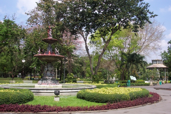
 The ornate fountain just inside the main entrance
The park was originally part of a palace built by Rama IV in 1866. He planned to use it after he abdicated but he died before it was completed. Rama V gave the palace to his younger brothers, including the crown prince, who stayed there before becoming king. The basic layout of the park today is as it was designed by Rama IV.
Rama V turned the park into a zoo. The animals were moved to the present location in Dusit when Rama V built the new royal city there around the turn of the twentieth century. After that, the park and its palace were turned over to the foreign ministry. The palace was then used to house foreign dignitaries visiting the kingdom.
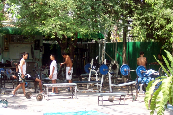
 A fitness "muscle beach" area near the back of the park
It's said that the park was used for meetings of cells plotting the 1932 coup which brought the absolute monarchy to an end.
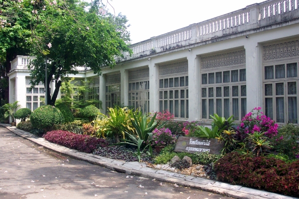
 The conservatory, now used as a school for city gardeners
In 1960 the park area was turned over to the city of Bangkok for use as a public park. In addition to the weight-lifting area pictured, there's also an area devoted to table tennis. The palace building itself still belongs to the foreign ministry.
Immediately behind the park is the small cramped temple of Wat Ratchapradit. If you exit the park by the west gate, you find yourself facing Lawd canal. Across the canal is the very interesting temple of Wat Ratchabophit.
Getting There
![]() The easiest way to get to Saranrom Park is by boat. Take the Chaophraya River Express to the Tha Thien pier, then walk through the market and up the short street. Wat Po is directly across the intersection, on your right. Walk past Wat Po to the end of the block and Saranrom Park is across the next intersection on the left. See our map of Ratanakosin for location information.
The easiest way to get to Saranrom Park is by boat. Take the Chaophraya River Express to the Tha Thien pier, then walk through the market and up the short street. Wat Po is directly across the intersection, on your right. Walk past Wat Po to the end of the block and Saranrom Park is across the next intersection on the left. See our map of Ratanakosin for location information.